Geosimulation is acclaimed as “the next big thing” in the field of geography. Please narrate your understanding of Geosimulation and some of the definitions. Briefly explain some of the challenges in Geosimulation. Question 2: We can use several tools in ArcGIS to model, examine, and explore spatial relationships that includes dependent and independent variables. Mention about at least two modeling techniques (available in ArcGIS) which can be used to model spatial relationships among variables. Question 3: The 3rd dimension (elevation information) can add value to any geographic model. Give two examples where we can use 3-dimensional modeling to understand complex processes on the surface of the Earth. Emphasize on the required data and associated issues. Question 4: Whether it is erosion or traffic movement on the road, many geographic data and phenomena are dynamic in nature (changes over time). However, it is difficult to incorporate time while modeling real-world human-environment interactions. Briefly describe a modeling and/or simulation project that can’t be completed without including temporal data. Mention specifically what type of temporal data is needed for your project and how to store that data in Geodatabase or other file formats. Question 5: Artificial Neural Networks (ANNs) are an attempt to address a range of difficult information processing, analysis, and modeling problems. Give a brief introduction of ANNs emphasizing on multi-level perceptron. Question 6: Based on what you learned in the class (TerrSet Labs), explain your understanding of the key features of the Land Change Modeler. Focus on the Land Change Analysis. Explain how to interpret gains and losses analysis graph, the map output, and the resulting map trend. Question 7: Urban geosimulation is heavily based on Cellular Automata which are used as a framework for geospatial modeling and simulation of complex spatial systems. Explain your understanding of Cellular Automata as applied to predicting urban growth scenarios. Question 8: What is Conway’s Game of Life and how it relates to Geospatial Modeling and Simulation. Question 9: Agent-based models (ABMs) involve multiple interacting agents within a simulation environment. ABMs have been developed for diverse range of subjects. Narrate one application of ABMs that involves geospatial data. Question 10: The Segregation Model (NetLogo) you designed in the class is based on Thomas Schelling’s segregation model. Explain Schelling’s model and how it can be applied to model and simulate geospatial issues.
Geosimulation is acclaimed as “the next big thing” in the field of geography. Please narrate your understanding of Geosimulation and some of the definitions. Briefly explain some of the challenges in Geosimulation. Question 2: We can use several tools in ArcGIS to model, examine, and explore spatial relationships that includes dependent and independent variables. Mention about at least two modeling techniques (available in ArcGIS) which can be used to model spatial relationships among variables. Question 3: The 3rd dimension (elevation information) can add value to any geographic model. Give two examples where we can use 3-dimensional modeling to understand complex processes on the surface of the Earth. Emphasize on the required data and associated issues. Question 4: Whether it is erosion or traffic movement on the road, many geographic data and phenomena are dynamic in nature (changes over time). However, it is difficult to incorporate time while modeling real-world human-environment interactions. Briefly describe a modeling and/or simulation project that can’t be completed without including temporal data. Mention specifically what type of temporal data is needed for your project and how to store that data in Geodatabase or other file formats. Question 5: Artificial Neural Networks (ANNs) are an attempt to address a range of difficult information processing, analysis, and modeling problems. Give a brief introduction of ANNs emphasizing on multi-level perceptron. Question 6: Based on what you learned in the class (TerrSet Labs), explain your understanding of the key features of the Land Change Modeler. Focus on the Land Change Analysis. Explain how to interpret gains and losses analysis graph, the map output, and the resulting map trend. Question 7: Urban geosimulation is heavily based on Cellular Automata which are used as a framework for geospatial modeling and simulation of complex spatial systems. Explain your understanding of Cellular Automata as applied to predicting urban growth scenarios. Question 8: What is Conway’s Game of Life and how it relates to Geospatial Modeling and Simulation. Question 9: Agent-based models (ABMs) involve multiple interacting agents within a simulation environment. ABMs have been developed for diverse range of subjects. Narrate one application of ABMs that involves geospatial data. Question 10: The Segregation Model (NetLogo) you designed in the class is based on Thomas Schelling’s segregation model. Explain Schelling’s model and how it can be applied to model and simulate geospatial issues.
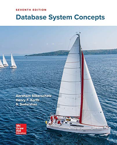
Database System Concepts
7th Edition
ISBN:9780078022159
Author:Abraham Silberschatz Professor, Henry F. Korth, S. Sudarshan
Publisher:Abraham Silberschatz Professor, Henry F. Korth, S. Sudarshan
Chapter1: Introduction
Section: Chapter Questions
Problem 1PE
Related questions
Question
Subject: GIS
Your answer is expected to be half a page to a page (for each question). This does not include images or
graphs or any other graphics (not required).
No citation is required.
Don’t copy paste material from web pages or source materials.
While answering, use your own words to express concepts, theories, and your thoughts.
Try to start answering a question on a new page.
Question 1: Geosimulation is acclaimed as “the next big thing” in the field of geography. Please narrate your
understanding of Geosimulation and some of the definitions. Briefly explain some of the challenges in
Geosimulation.
Question 2: We can use several tools in ArcGIS to model, examine, and explore spatial relationships that
includes dependent and independent variables. Mention about at least two modeling techniques (available in
ArcGIS) which can be used to model spatial relationships among variables.
Question 3: The 3rd dimension (elevation information) can add value to any geographic model. Give two
examples where we can use 3-dimensional modeling to understand complex processes on the surface of the
Earth. Emphasize on the required data and associated issues.
Question 4: Whether it is erosion or traffic movement on the road, many geographic data and phenomena are
dynamic in nature (changes over time). However, it is difficult to incorporate time while modeling real-world
human-environment interactions. Briefly describe a modeling and/or simulation project that can’t be completed
without including temporal data. Mention specifically what type of temporal data is needed for your project and
how to store that data in Geodatabase or other file formats.
Question 5: Artificial Neural Networks (ANNs) are an attempt to address a range of difficult information
processing, analysis, and modeling problems. Give a brief introduction of ANNs emphasizing on multi-level
perceptron.
Question 6: Based on what you learned in the class (TerrSet Labs), explain your understanding of the key
features of the Land Change Modeler. Focus on the Land Change Analysis. Explain how to interpret gains and
losses analysis graph, the map output, and the resulting map trend.
Question 7: Urban geosimulation is heavily based on Cellular Automata which are used as a framework for
geospatial modeling and simulation of complex spatial systems. Explain your understanding of Cellular
Automata as applied to predicting urban growth scenarios.
Question 8: What is Conway’s Game of Life and how it relates to Geospatial Modeling and Simulation.
Question 9: Agent-based models (ABMs) involve multiple interacting agents within a simulation environment.
ABMs have been developed for diverse range of subjects. Narrate one application of ABMs that involves
geospatial data.
Question 10: The Segregation Model (NetLogo) you designed in the class is based on Thomas Schelling’s
segregation model. Explain Schelling’s model and how it can be applied to model and simulate geospatial
issues.
Expert Solution
This question has been solved!
Explore an expertly crafted, step-by-step solution for a thorough understanding of key concepts.
This is a popular solution!
Trending now
This is a popular solution!
Step by step
Solved in 3 steps

Knowledge Booster
Learn more about
Need a deep-dive on the concept behind this application? Look no further. Learn more about this topic, computer-science and related others by exploring similar questions and additional content below.Recommended textbooks for you
Database System Concepts
Computer Science
ISBN:
9780078022159
Author:
Abraham Silberschatz Professor, Henry F. Korth, S. Sudarshan
Publisher:
McGraw-Hill Education

Starting Out with Python (4th Edition)
Computer Science
ISBN:
9780134444321
Author:
Tony Gaddis
Publisher:
PEARSON
Digital Fundamentals (11th Edition)
Computer Science
ISBN:
9780132737968
Author:
Thomas L. Floyd
Publisher:
PEARSON

Database System Concepts
Computer Science
ISBN:
9780078022159
Author:
Abraham Silberschatz Professor, Henry F. Korth, S. Sudarshan
Publisher:
McGraw-Hill Education

Starting Out with Python (4th Edition)
Computer Science
ISBN:
9780134444321
Author:
Tony Gaddis
Publisher:
PEARSON

Digital Fundamentals (11th Edition)
Computer Science
ISBN:
9780132737968
Author:
Thomas L. Floyd
Publisher:
PEARSON

C How to Program (8th Edition)
Computer Science
ISBN:
9780133976892
Author:
Paul J. Deitel, Harvey Deitel
Publisher:
PEARSON
Database Systems: Design, Implementation, & Manag…
Computer Science
ISBN:
9781337627900
Author:
Carlos Coronel, Steven Morris
Publisher:
Cengage Learning
Programmable Logic Controllers
Computer Science
ISBN:
9780073373843
Author:
Frank D. Petruzella
Publisher:
McGraw-Hill Education