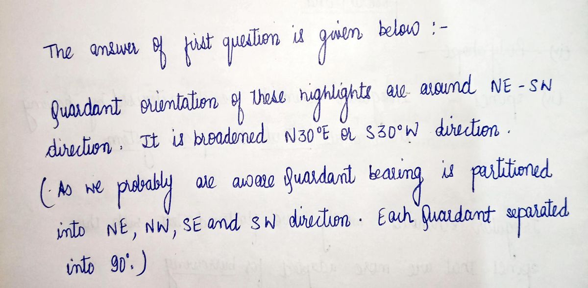
Figure 3 is a simple topographic map of Manhattan, the Bronx, and the Palisades of New Jersey. Elevations of land surface are shown by patterns indicated in the legend. Waterways are white. Note that with the exception of mid- and lower Manhattan, much of the region is characterized by a series of elongated hills (called ridges) and valleys that are roughly parallel to (a) each other, (b) to the length of Manhattan, and (c) to the Hudson and parts of the Harlem and East Rivers. What is the approximate compass quadrant bearing of these features? What is their azimuth?
Figure 3 is a simple topographic map of Manhattan, the Bronx, and the Palisades of New Jersey. Elevations of land surface are shown by patterns indicated in the legend. Waterways are white. Note that with the exception of mid- and lower Manhattan, much of the region is characterized by a series of elongated hills (called ridges) and valleys that are roughly parallel to (a) each other, (b) to the length of Manhattan, and (c) to the Hudson and parts of the Harlem and East Rivers. What is the approximate compass quadrant bearing of these features? What is their azimuth?
Applications and Investigations in Earth Science (9th Edition)
9th Edition
ISBN:9780134746241
Author:Edward J. Tarbuck, Frederick K. Lutgens, Dennis G. Tasa
Publisher:Edward J. Tarbuck, Frederick K. Lutgens, Dennis G. Tasa
Chapter1: The Study Of Minerals
Section: Chapter Questions
Problem 1LR
Related questions
Question
100%

Transcribed Image Text:Certainly! Here is the transcribed text for educational use:
---
**Topographic Map of New York and New Jersey Region**
Figure 3 is a simple topographic map of Manhattan, the Bronx, and the Palisades of New Jersey. Elevations of land surface are shown by patterns indicated in the legend. Waterways are white. Note that with the exception of mid- and lower Manhattan, much of the region is characterized by a series of elongated hills (called ridges) and valleys that are roughly parallel to (a) each other, (b) to the length of Manhattan, and (c) to the Hudson and parts of the Harlem and East Rivers.
- **Questions for Consideration:**
- What is the approximate compass quadrant bearing of these features?
- What is their azimuth?
---
This section provides insight into the geographical features of the area, focusing on the alignment of natural structures in relation to local landmarks. Consider how these physical characteristics influenced historical settlement and urban development in New York and New Jersey.

Transcribed Image Text:**Figure 3: Topographic Map of Manhattan, the Bronx, and the Palisades of New Jersey**
The image is a topographic map highlighting the elevation and water bodies in the area of Manhattan, the Bronx, and adjacent New Jersey, including the Palisades.
**Features:**
- **Elevation Levels:**
- Areas shaded in light gray represent elevations between 0 and 60 feet.
- Areas shaded in dark gray indicate elevations greater than 60 feet.
- **Water:**
- Water bodies are highlighted in white, encompassing the rivers and surrounding areas.
- **Geographical Markings:**
- The map includes a labeled section titled "THE PALISADES," a prominent escarpment located across the Hudson River from Manhattan.
- A line labeled "X" extends from the Palisades towards the Bronx, demonstrating geographical relations or possibly a cross-sectional view.
- **Orientation and Scale:**
- A compass rose points northwards.
- A scale in miles (0-3) visually approximates distances within this region.
This map serves as a visual representation of the geographic and topographic characteristics of the specified areas, providing insight into the natural elevation changes and layout in relation to waterways.
Expert Solution
Step 1

Step by step
Solved in 2 steps with 2 images

Follow-up Questions
Read through expert solutions to related follow-up questions below.
Follow-up Question
please type out your anwser to both of the questions because i can not understand your hand writing.
Solution
Recommended textbooks for you

Applications and Investigations in Earth Science …
Earth Science
ISBN:
9780134746241
Author:
Edward J. Tarbuck, Frederick K. Lutgens, Dennis G. Tasa
Publisher:
PEARSON

Exercises for Weather & Climate (9th Edition)
Earth Science
ISBN:
9780134041360
Author:
Greg Carbone
Publisher:
PEARSON

Environmental Science
Earth Science
ISBN:
9781260153125
Author:
William P Cunningham Prof., Mary Ann Cunningham Professor
Publisher:
McGraw-Hill Education

Applications and Investigations in Earth Science …
Earth Science
ISBN:
9780134746241
Author:
Edward J. Tarbuck, Frederick K. Lutgens, Dennis G. Tasa
Publisher:
PEARSON

Exercises for Weather & Climate (9th Edition)
Earth Science
ISBN:
9780134041360
Author:
Greg Carbone
Publisher:
PEARSON

Environmental Science
Earth Science
ISBN:
9781260153125
Author:
William P Cunningham Prof., Mary Ann Cunningham Professor
Publisher:
McGraw-Hill Education

Earth Science (15th Edition)
Earth Science
ISBN:
9780134543536
Author:
Edward J. Tarbuck, Frederick K. Lutgens, Dennis G. Tasa
Publisher:
PEARSON

Environmental Science (MindTap Course List)
Earth Science
ISBN:
9781337569613
Author:
G. Tyler Miller, Scott Spoolman
Publisher:
Cengage Learning

Physical Geology
Earth Science
ISBN:
9781259916823
Author:
Plummer, Charles C., CARLSON, Diane H., Hammersley, Lisa
Publisher:
Mcgraw-hill Education,